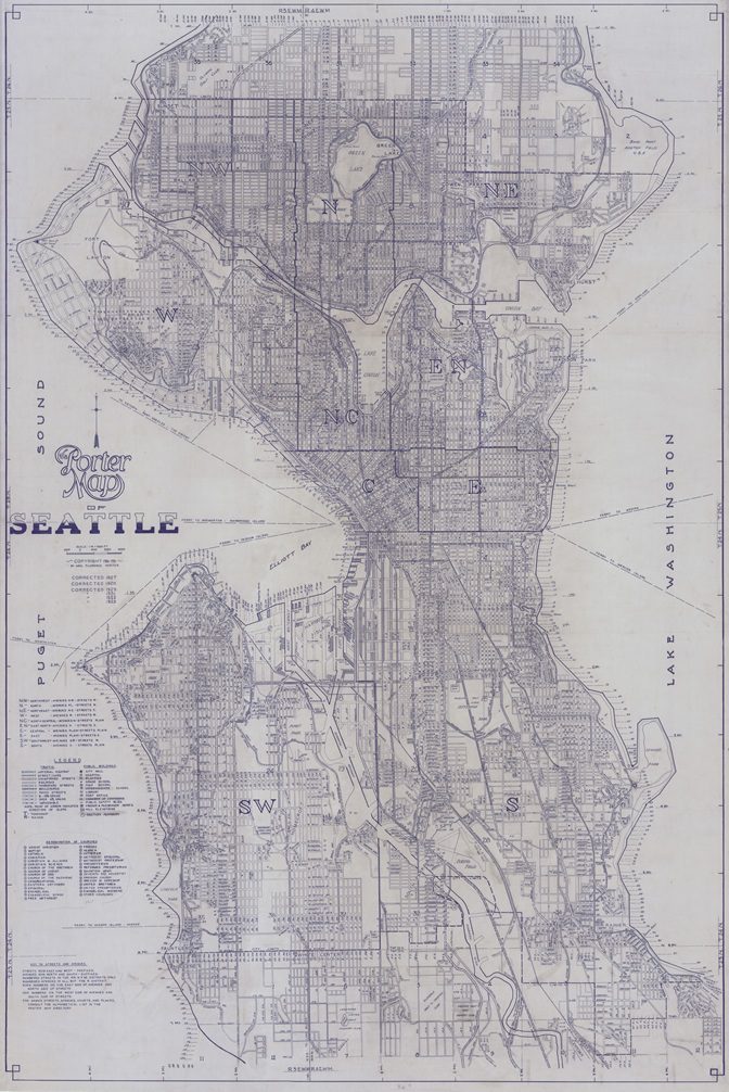
Drawn in 1926, the Porter Map of Seattle is a large wall map covering the entire city. It’s impressively detailed, with keys describing public buildings, road types and grades, street designations, and churches according to denomination. The author is shown as Mrs. Florence Porter. The name was unfamiliar to us, so we started digging!
We found several articles in the Seattle Times between 1924 and 1936 heralding Mrs. Porter’s cartographic endeavors. Inspired by a need she witnessed daily in her position as head of the room registry department at the YWCA where she helped women find housing, she designed a guide and directory to the city specifically with newcomers in mind. The booklet included a street directory, traffic rules, streetcar and ferry lines, lists of hospitals, hotels, markets, restaurants, and more (copies of the guide are held by the Seattle Public Library).
It was soon officially approved by the Chamber of Commerce and updated into subsequent editions. Mrs. Porter began working on developing a large wall map to complement the guide. In a June 13, 1926 Seattle Times article entitled “How to Get There Answered,” Mrs. Porter explained that, even though mapmaking had been a hobby of hers since childhood, Seattle was “the hardest city, with its broken and twisted streets, and small courts and places.” Nevertheless, she described her map as one that would let a person “instantly and exactly locate any address, and at the same time see all related information in getting to the place, or the surrounding interests of that locality.”
Updates were made annually, which Mrs. Porter claimed made it “a virtually perpetual map.” Our Porter wall map was last updated in 1935. View or download your copy at our Digital Collections site!